New York Map - Political
In social studies, a political map of New York shows the boundaries of cities, counties, states, and countries. It also displays the location of major cities, capitals, and other important landmarks. Understanding the political map of New York is crucial for understanding its governance, population distribution, and administrative divisions.
Study Guide
Here are some key points to focus on when studying the political map of New York:
- Administrative Divisions: Learn about the different counties and cities in New York. Understand their boundaries and the major administrative centers within each division.
- Capital and Major Cities: Identify the capital of New York and its location on the map. Also, familiarize yourself with the locations of major cities such as New York City, Buffalo, Rochester, and Syracuse.
- State Borders: Study the borders of New York with neighboring states such as Pennsylvania, New Jersey, Connecticut, Massachusetts, and Vermont. Understand the significance of these borders in terms of governance and interactions with other states.
- Landmarks and Symbols: Look for important landmarks and symbols on the map, such as national parks, rivers, lakes, and mountains. Understand their significance in the geography and history of New York.
- Population Distribution: Analyze the population distribution across different regions of New York as indicated on the political map. Consider the factors that contribute to population concentration in certain areas.
By focusing on these key points, you will develop a comprehensive understanding of the political map of New York and its significance in the context of social studies.
Happy studying!
.◂Social Studies Worksheets and Study Guides Fifth Grade. New York Map - Political
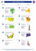
Worksheet/Answer key New York Map - Political
  Worksheet/Answer key
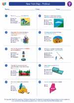
 New York Map - Political
  Worksheet/Answer key
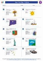
 New York Map - Political

 Worksheet/Answer key
 Worksheet/Answer key

The resources above cover the following skills:
National Curriculum Standards for Social Studies (NCSS)
PEOPLE, PLACES, AND ENVIRONMENTS
SOCIAL STUDIES PROGRAMS SHOULD INCLUDE EXPERIENCES THAT PROVIDE FOR THE STUDY OF PEOPLE, PLACES, AND ENVIRONMENTS.
KNOWLEDGE - Learners will understand:
Concerts such as: location, region, place, and migration, as well as human and physical systems.
The concept of regions identifies links between people in different locations according to specific criteria (e.g., physical, economic, social, cultural, or religious).
PROCESSES - Learners will be able to:
Ask and find answers to geographic questions related to regions, nations, and the world in the past and present.
GLOBAL CONNECTIONS
SOCIAL STUDIES PROGRAMS SHOULD INCLUDE EXPERIENCES THAT PROVIDE FOR THE STUDY OF GLOBAL CONNECTIONS AND INTERDEPENDENCE.
PROCESSES - Learners will be able to:
Use maps, charts, and databases to explore patterns and predict trends regarding global connections at the community, state, or national level.